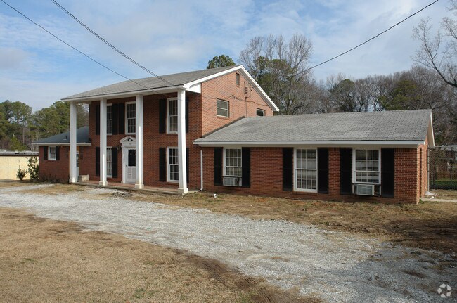
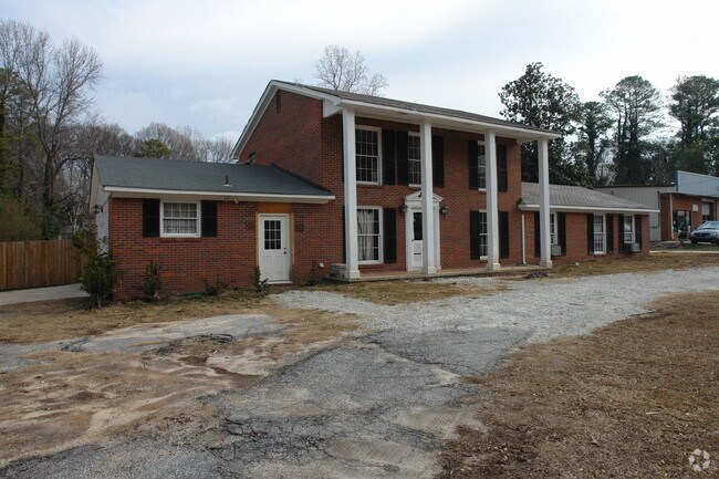
Property Record
298 N Main St, Jonesboro, GA 30236

NEARBY LISTINGS FOR SALE OR LEASE
Property Detail
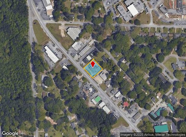
298 N Main St
Atlanta-Sandy Springs-Roswell, GA
Adamsons Hwy 41
13-0209C-00B-008
COMMERCIAL
Officebuilding
Clayton
X
Georgia
13063C0086F
209
2025
0.45 AC
2025
North Clayton/Airport
040635
Atlanta
2,146 SF
DEMOGRAPHICS near 298 N Main St
1 Mile
3 Mile
5 Mile
2024 Total Population
7,920
69,174
183,341
2029 Population
7,873
68,975
182,868
Pop Growth 2024-2029
(0.59%)
(0.29%)
(0.26%)
Average Age
35
36
36
2024 Total Households
3,058
24,849
65,219
HH Growth 2024-2029
(0.62%)
(0.26%)
(0.23%)
Median Household Inc
$45,317
$53,799
$53,208
Avg Household Size
2.60
2.70
2.70
2024 Avg HH Vehicles
2.00
2.00
2.00
Median Home Value
$126,805
$169,770
$173,688
Median Year Built
1982
1984
1985
Nearby Places
Map Layers
Map Styles
 Street
 Aerial
- Restaurants
- Banks
- Shops
- Fitness
- Groceries
PUBLIC TRANSPORTATION
AIRPORT
Hartsfield - Jackson Atlanta International
DRIVE
WALK
Distance
Hartsfield - Jackson Atlanta International
18 min
10.2 mi
Nearby Properties
Address
Land Use
TOTAL SIZE
Lot Size
Zoning
Address
Land Use
TOTAL SIZE
Lot Size
Zoning
231,046 SF
97.58 AC
C
Address
Land Use
TOTAL SIZE
Lot Size
Zoning
40,472 SF
116.70 AC
HI
Address
Land Use
TOTAL SIZE
Lot Size
Zoning
194,682 SF
27.80 AC
OI
Address
Land Use
TOTAL SIZE
Lot Size
Zoning
324 SF
49.49 AC
RM
Address
Land Use
TOTAL SIZE
Lot Size
Zoning
11.31 AC
RM
Address
Land Use
TOTAL SIZE
Lot Size
Zoning
250 SF
31.25 AC
RM
Address
Land Use
TOTAL SIZE
Lot Size
Zoning
123,000 SF
48 AC
RS110
Address
Land Use
TOTAL SIZE
Lot Size
Zoning
1,140 SF
187.84 AC
MX
Address
Land Use
TOTAL SIZE
Lot Size
Zoning
200 SF
23.02 AC
RM
Address
Land Use
TOTAL SIZE
Lot Size
Zoning
424 SF
54.79 AC
RM
Address
Land Use
TOTAL SIZE
Lot Size
Zoning
230 SF
27.09 AC
RM
Address
Land Use
TOTAL SIZE
Lot Size
Zoning
123,842 SF
31.53 AC
RS110
Address
Land Use
TOTAL SIZE
Lot Size
Zoning
200,370 SF
23.81 AC
C
Address
Land Use
TOTAL SIZE
Lot Size
Zoning
351,207 SF
20 AC
HI
Address
Land Use
TOTAL SIZE
Lot Size
Zoning
316 SF
34.30 AC
RG75
Address
Land Use
TOTAL SIZE
Lot Size
Zoning
500,415 SF
26.99 AC
HI
Address
Land Use
TOTAL SIZE
Lot Size
Zoning
224 SF
25 AC
C
Address
Land Use
TOTAL SIZE
Lot Size
Zoning
252 SF
27.14 AC
RM
Address
Land Use
TOTAL SIZE
Lot Size
Zoning
200 SF
20.23 AC
RM
Address
Land Use
TOTAL SIZE
Lot Size
Zoning
190 SF
21.66 AC
RM
Address
Land Use
TOTAL SIZE
Lot Size
Zoning
14,230 AC
C
Address
Land Use
TOTAL SIZE
Lot Size
Zoning
220 SF
26.84 AC
RM
Address
Land Use
TOTAL SIZE
Lot Size
Zoning
252 SF
23.62 AC
RM
Address
Land Use
TOTAL SIZE
Lot Size
Zoning
30.90 AC
RS110
Address
Land Use
TOTAL SIZE
Lot Size
Zoning
65,798 SF
7.41 AC
C
Address
Land Use
TOTAL SIZE
Lot Size
Zoning
250,048 SF
31.80 AC
HI
Address
Land Use
TOTAL SIZE
Lot Size
Zoning
208 SF
19.26 AC
RM
Address
Land Use
TOTAL SIZE
Lot Size
Zoning
155,204 SF
21.37 AC
I
Address
Land Use
TOTAL SIZE
Lot Size
Zoning
200 SF
13.12 AC
RM
Address
Land Use
TOTAL SIZE
Lot Size
Zoning
80,535 SF
12.80 AC
C
The World's #1 Commercial Real Estate Marketplace
Connect with us
© 2025 CoStar Group
The information above has been obtained from sources believed reliable. While we do not doubt its accuracy we have not verified it and make no guarantee, warranty or representation about it. It is your responsibility to independently confirm its accuracy and completeness. Any projections, opinions, assumptions, or estimates used are for example only and do not represent the current or future performance of the property. The value of this transaction to you depends on tax and other factors which should be evaluated by your tax, financial, and legal advisors. You and your advisors should conduct a careful, independent investigation of the property to determine to your satisfaction the suitability of the property for your needs.